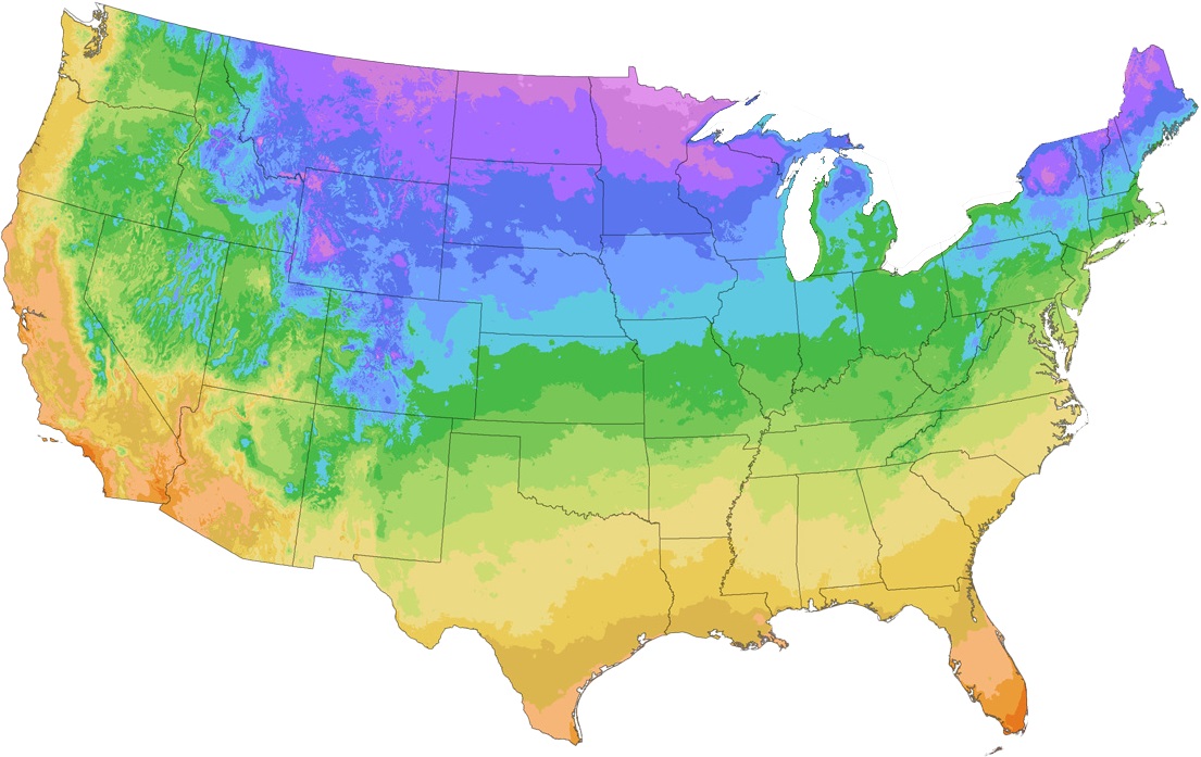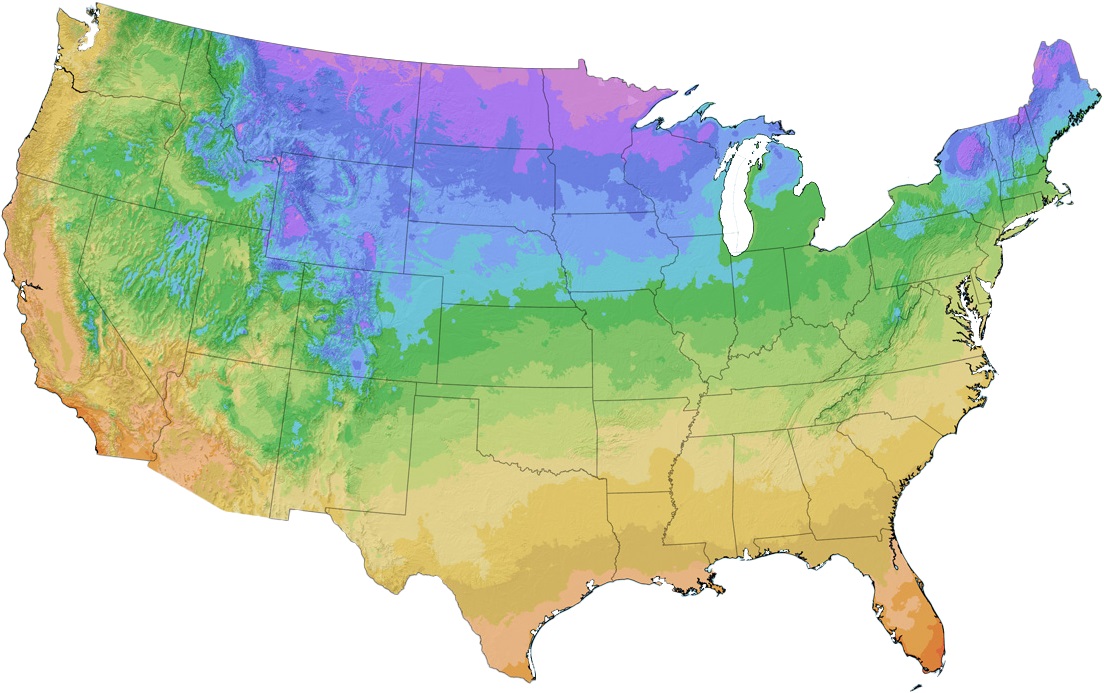

Many gardeners who’ve been noticing new weather patterns in their areas will be interested in the USDA’s new map for hardiness zones, based on the coldest winter temperatures for a given area, which has been updated for the first time in over 10 years. According to Chris Daly, director of the PRISM Climate Group at Oregon State University which partnered with the USDA on the project, reports that this year’s map for the contiguous U.S. is about 2.5 degrees Fahrenheit warmer than the 2012 map, and that roughly half of the country is now a half-zone warmer than in the past. This means that varieties that may have been borderline for an area are now less likely to be killed by low winter temperatures.
Over 24,000 zip codes have changed, which accounts for just shy of 60% of the country. To see if your zone has been updated, enter your garden’s zipcode at the USDA’s site or our website. Since the map is based on winter lows, it is less good at predicting how plants will fare in summer heat, but gardeners in newly-warmer zones may want to take this into account as well.


